How to Check Your Field's Crop Health by Satellite for Free in Rwanda
You don't need a drone or an agronomist's visit to see how your crop is doing. Here's how to read your own field from satellite, for free, in a few minutes.
The quickest way to check your field's crop health by satellite in Rwanda, for free, is Umujyanama at umujyanama.hekitari.com. Find your parcel by its UPI or its village, say what crop is on it and when you planted, and it shows you the crop's condition for its stage, a vegetation-health map of the field, and an expected yield. All of it is in Kinyarwanda, with English one tap away.
Step 1: Find your land
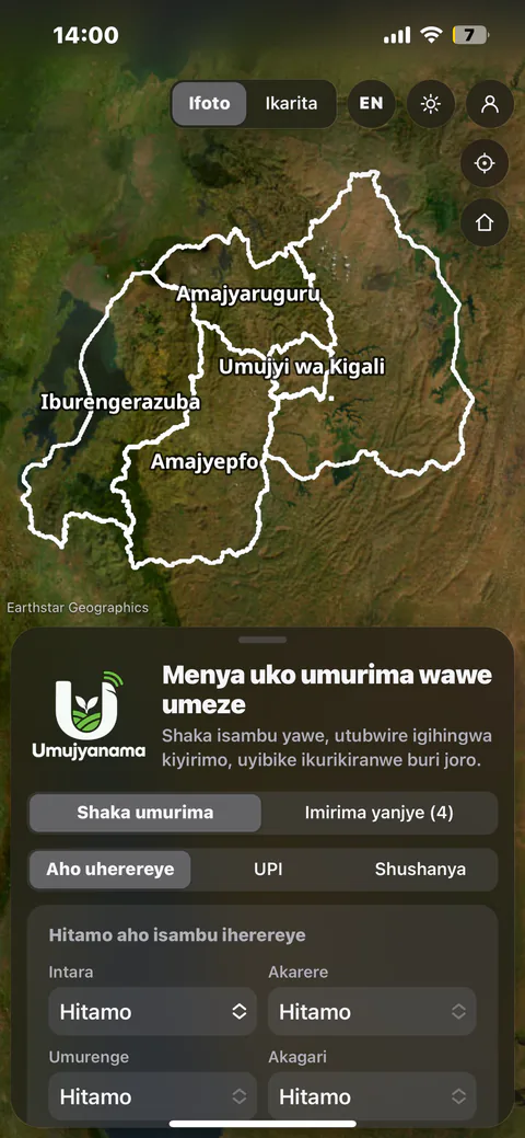
Open umujyanama.hekitari.com on your phone. The first screen is the search itself, with three ways to say which ground is yours:
- UPI: type the number on your land title and it is looked up in the land registry
- Aho uherereye (location): choose your Intara, Akarere, Umurenge, Akagari and Umudugudu, then tap your parcel on the map
- Shushanya (draw): tap the corners of your field on the satellite picture
Step 2: Draw the part that is actually planted
A registered parcel is rarely all one crop: there may be a house, trees or a second crop on it. Once the parcel is chosen you can draw the actual field inside it (Shushanya umurima nyawo). That part is what the satellite measures, so the reading describes your crop and not your roof.
Step 3: Say what is growing and when it was planted
Choose the crop from 50 (or type any other), the variety if you know it, the planting date, and whether the field can be irrigated. The planting date matters most: the crop's calendar starts that day, so the field is judged against what a healthy crop should look like at that exact age, not against a generic season.
Step 4: Read the result
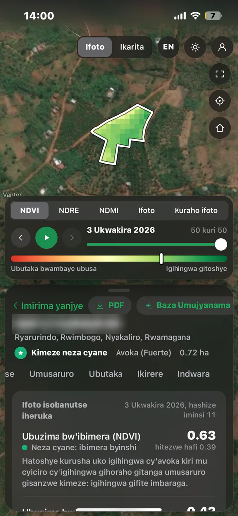
Within moments you get a verdict and the latest clear satellite image of the field. Kimeze neza cyane means the crop matches the curve of a healthy field, Kimeze neza means it is within the normal range, and Gifite ikibazo means it is behind and worth a visit. The colour map shows where in the field: green is strong growth, yellow and red are thin or stressed.
What is NDVI, and what is a good value?
NDVI (Ubuzima bw'ibimera) measures how green and dense the canopy is, from 0 for bare soil to about 0.9 for a full, vigorous crop. A good value depends on the crop and its stage: newly emerged maize reads low and is still healthy. That is why Umujyanama shows what your crop should read on that day beside what it does read. It also shows NDRE (leaf nitrogen, Ubuzima bw'ibibabi) and NDMI (leaf water, Ubuhehere), which catch hunger and drought before they show in the leaves.
How often is the satellite reading updated?
Saved fields are brought up to date every night from Sentinel-2 imagery, which passes over Rwanda every few days at 10 m resolution. Every pixel is checked for cloud, and a date only counts when at least half the field is clear. The Uko wahindutse tab keeps a year of readings, so you can play the season back and see when the field changed.
Is it really free?
Yes. The first analysis needs no account at all. A free account, opened in a minute with a phone number or email, keeps the field and adds soil, weather, disease diagnosis from a photo, a PDF report and Baza Umujyanama, an adviser you can ask by voice in Kinyarwanda. Fields you follow are re-read from satellite every night.